


LAKE OF THE OZARKS, Mo. — Trees were uprooted and homes were damaged when a line of powerful storms ripped through the Lake of the Ozarks region in the early hours of Monday, Feb. 27.
According to Meteorologist Shelby Melto, with the National Weather Service (NWS) in Springfield, the event fired up in Texas and Oklahoma as an imbedded superstorm moving north. “A line of powerful thunderstorms pushed through Kansas and began entering southwest Missouri from around 11 p.m. to 4 a.m.,” Melto verified. The NWS issued multiple severe thunderstorm warnings, presenting wind gusts as the main threat. “There was hardly any lighting and no hail in this storm event,” Melto noted.
A tornado warning was first issued for Dade and Cedar Counties in Missouri. “The radar picked up a tornado debris signature,” Melto said. “This radar imagery means there could be a tornado on the ground lifting debris up into the air. We are still trying to verify what happened with area emergency management managers. We may send out a survey team, depending on what they find.”
As the band of storms moved through the Lake of the Ozarks area, a severe thunderstorm warning was issued. According to the Melto, from approximately 2:45 and 3:15 a.m., the NWS again picked up a tornado debris signature on radar, indicating a possible tornado on the ground. A tornado warning was issued for areas in northwest Camden County, including the communities of Climax Springs and Macks Creek.
Camden County Emergency Management Director Sam Henley reported early on Monday morning that there were no official reports of a tornado. “We have received reports of downed trees and power lines and a barn destroyed on A Highway in Richland,” Henley said. “We are waiting on more information as to whether that was in Camden or Laclede county.” There were also reports of downed trees in Montreal.

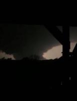
photo by Linda Jeffries, via Facebook
The storm produced widespread damage, with reports of high winds damaging homes in Camdenton and Barnett, a roof blown off in Brumley, dock damage across the Lake area, and electrical outages in multiple cities around the region, including Macks Creek, Brumley, Greenview and Versailles. Electric services were quickly restored.
Tina Marie Winick reported tree limbs and debris were tossed around on their five-acre property located on Highway Y in Eldon. “We heard the wind, it sounded like a wind tunnel. Then we heard shattering glass where something shattered our kitchen window,” Winick said.
There were no reports of injury in this storm event.
“I have fielded a lot of questions about our Hyper-Reach Mass Notification System that issued alerts between 2 and 3 a.m.,” Camden County EMS Director Sam Henley said. The mass notification system automatically rebroadcasts 10 out of 60 safety alerts from the US NWS in Springfield.
The 10 safety alerts set to go off in Camden County include: Earthquake, Flash Flood, High Wind, Ice Storm, Law Enforcement, Local Area Emergency, Severe Thunderstorm, Shelter in Place, Tornado, and Winter Storm.
Melto said she was asked why some did not receive all the warnings. “Warnings from the NWS are geo-located to the address registered with Hyper-Reach,” Melto explained. “Therefore, one person in an area may receive a warning, while others may not, depending on the physical, registered location.”
To receive, or turn off, Hyper-Reach notifications call the Camden County EMS office at 573-346-7108. Citizens are asked to report weather related damages by calling the office or online at https://emacamdenmo.org/damage/.
Past Coverage: Historic Storms At The Lake
On the night of May 22, 2019, an EF-1 tornado touched down at 10:56 p.m. about a mile southw…

The Lake of the Ozarks has been well-below freezing temperatures for more than a week, and m…

LAKE OF THE OZARKS, Mo. —A violent storm that raced through central Missouri on Wednesday, A…

Homes, docks and property went under water as the Lake of the Ozarks experienced massive flo…

LAKE OF THE OZARKS, Mo. — The Lake has crested and there is no rain in sight for the week ah…

LAKE OF THE OZARKS, Mo. — In the weekend's catastrophic flooding and subsequent high lake le…

LAKE OF THE OZARKS, Mo. — Heavy rains and a rising lake level spelled trouble for homes and …

A short tour of the Lake. A freak storm. Three people, never seen again.


