
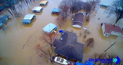
Would floodplain changes by the State Emergency Management Agency (SEMA) put Lake of the Ozarks homes under water?
A town hall meeting hosted by the Camden County Republican Central Committee (CCRCC) on Tuesday, February 25 in Camdenton was held to inform citizens about proposed revisions to the statewide Federal Emergency Management (FEMA) and State Emergency Management (SEMA) Floodplain Map.
According to CCRCC Chairman John Beckett, SEMA representatives declined an invitation to attend the meeting.
However, after the meeting, on Feb. 26, Governor Mike Kehoe and SEMA were contacted to allow them the opportunity to respond to concerns presented at the town hall meeting.
Katy Linnenbrink, SEMA Public Information Officer, responded on Wednesday, February 26. The response is republished below.
Question: What is the timeline for initiating the revisions to the floodplain map?
Answer: No revisions have been made to the Lake of the Ozarks floodplain map. The Lake of the Ozarks mapping project is an ongoing effort with the current draft data still being refined to incorporate additional data. There is no preliminary map or data at this stage, as this will only occur once all data has been integrated into the analysis and modeling process.
It typically takes up to two years following preliminary issuance for the new maps to become effective. It is anticipated that it will be late fall of 2025 before SEMA can proceed with preliminary issuance of the flood risk data and updated floodplain maps.
The current effective floodplain maps that communities have adopted will remain in effect until that time. Camden, Miller and Morgan counties adopted their maps in 2018; Benton County adopted its map in 2009.
Once the analysis is complete, the updated flood risk data will be made publicly available for review and comment.
Question: Will you continue to move forward with map revisions in light of President Donald J. Trumps Executive Order 14148 which revoked Executive Order 13690 and paused the implementation of the Federal Flood Risk Management Standard?
Answer: Regarding President Trump’s revoking of Executive Order 14030. The Climate-Related Financial Risk order signed by President Biden did not apply in Missouri. No “climate change” data is associated with the RiskMAP data sets used in this project.
Linnenbrink responded again on Thursday, February 27 to a subsequent series of questions. The following is her second response:
Question: What data was used to draw these maps?
Answer: To develop the most accurate, up-to-date flood risk data possible, our teams follow established data collection and analysis processes. This involves analyzing water runoff patterns, ponding and storage areas, precipitation frequency and volume, soil types, land use and topography (LiDAR – collected by aircraft). In the Lake of the Ozarks study area, updated analysis will be incorporating acquired lake bathymetry. Bathymetry provides a description of the underwater terrain (depth and storage capacity) and how water moves through the lake, which significantly improves our understanding of water flow dynamics.
Question: What maps have been introduced to the Camden County Floodplain Manager?
Answer: In the interest of transparency, SEMA made initial flood risk data available on a publicly accessible website. It was determined this data did not account for all the complicated characteristics of the Lake of the Ozarks.
The flood risk data has been misinterpreted to mean that flood elevations in some areas could be raised by several feet. However, while more complete analysis is still being conducted, incorporating the lake bathymetry into the modeling is expected to considerably lower the water surface elevations from the flood risk data initially released. And as was mentioned yesterday, once the analysis is complete, the updated flood risk data will, of course, be made publicly available for review and comment.
Question: What gives SEMA the statutory authority outside of FEMA to draft flood maps for Missouri? Please refer to the laws that give SEMA that authority?
Answer: SEMA is a Cooperating Technical Partner (CTP) for the RISKMap program, meaning we help local communities that participate in the NFIP with hazard identification and risk assessment and provide support, data and other resources needed for local officials to make decisions about floodplain management. Every participating NFIP community has a floodplain administrator who we work with throughout this process.


