





ELDON, Mo. — A fast-moving line of storms moving through central Missouri on Thursday was accompanied by hail in some areas.
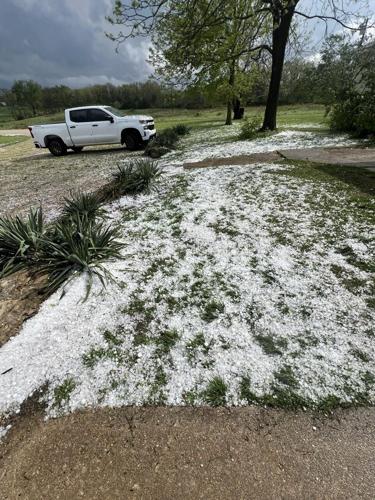
In Eldon, some residents saw golf-ball-sized hail.

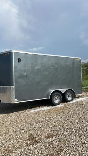
Photos submitted to LakeExpo by Peter Wansing, owner of PJS Enterprises construction company in Eldon, show extremely large hail that fell between 3 – 4 p.m. on April 18.
Wansing's new cargo trailer was pelted heavily by the hail.


National Weather Service Severe Thunderstorm Warnings followed the system as it pushed eastward across the state, leaving cooler temperatures and hail-damaged vehicles and roofs in its wake.
Precipitation was spotty with the fast-moving line of storms.


The National Weather Service has issued a Severe Thunderstorm Watch for the Lake of the Ozarks area until 8 p.m. on Thursday.
The NWS forecast is calling for cooler temperatures into early next week, with daytime highs in the low- to mid-60s and overnight lows in the 40s through Sunday night. However, no precipitation is expected again until Monday night.


