
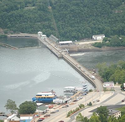
LAKE OF THE OZARKS, Mo. – It appears the Federal Energy Regulatory Commission has gotten the message sent by Lake property owners, the business community, local public officials and U.S. Congress heavy hitters. FERC agreed Monday, Sept. 26, to a rehearing to resolve the issues within the Ameren Missouri project boundary.
"We feel FERC's decision to grant a rehearing of their decision on the Shoreline Management Plan is good news for the entire lake-area community," Ameren Shoreline Manager Jeff Green said. "Ameren Missouri has proposed a reasonable, common sense solution to resolve the issue of non-conforming structures within the Project Boundary. Where lands are not really needed for project purposes, we believe the best solution would be to adjust the Project Boundary so as many structures as possible that are identified as encroachments under the existing boundary are no longer encroachments. Then we would work to resolve the remaining situations on a case-by-case basis in a manner that balances the interests of everyone involved. We hope FERC will give our proposals full and fair consideration in their final determination in this matter."
After years of work to create a Shoreline Management Plan as part of its license renewal to operate Bagnell Dam, Ameren Missouri on July 26, 2011, received an order modifying and approving the plan. The document showed FERC’s heavy hand regarding non-conforming structures within the utility company’s project boundary: In total, FERC’s decision would potentially require the removal of some 4,000 structures including lake homes, entire condo buildings, gazebos, seawalls, wastewater treatment systems, boardwalks, decks, the list goes on.
FERC’s decision sent a wave of outrage and immediate response from the Lake’s business community that rippled among full-time residents and part-time homeowners across the Midwest. The Lake’s three Chambers of Commerce, the Convention & Visitor Bureau, municipal leaders, county commissioners, state and national politicians all pressed pen to paper to sign hundreds of arguments against FERC’s decision.
The decision placed Ameren Missouri in a precarious position as enforcer of FERC’s intolerance for structures within the boundary with full knowledge that individual and class action lawsuits lay prepared for filing as property owners all over the Lake take action to protect their interests.
In an attempt to add reason and flexibility to the issue, Ameren amended the SMP to provide several options to FERC for resolving the issue (the options below are a common sense interpretation of the legal language in the document):
1. Redrawing the project boundary to accommodate existing structures and Ameren’s utility needs while on a case-by-case basis handling non-conforming structures still within the redrawn boundary (This appears the plan Ameren is pushing during the rehearing approved Monday).
2. Transferring title to homeowners for property lying within Ameren's project boundary (monetary requirements are unclear under this option).
3. Leasing property lying within the project boundary (40-year renewable).
4. Registering current non-conforming structures that lie within the project boundary and allowing them to remain under certain conditions.
These options did not appeal to FERC. The response was no, no, no and no – in short.
Here’s the long version verbatim from FERC’s modification to the SMP:
“Lands that are included in the project boundary are needed for particular project purposes. Non-conforming structures located on lands in the project boundary can have adverse affects on project purposes and the project’s scenic, recreational, and environmental values and are inconsistent with the licensee’s obligations and responsibilities under standard article 5… Further, it should be noted that the Commission does not condone residential development and occupancy of project lands, since such residential use is inconsistent with the Commission’s policy of maximizing public recreational development. Consequently, AmerenUE’s SMP must demonstrate compliance with the Commission’s policies on these issues related to non-conforming structures at the project.
“As such, AmerenUE should be required to develop a plan and schedule to inspect and identify all lands within the project boundary; identify existing non-conforming structures and encroachments; identify the project purposes being served by the underlying lands, and take appropriate actions to resolve such non-conforming structures and encroachments with the goal of removing them from the project boundary. In the majority of cases, the existing non-conforming structure/encroachment should be removed in a timely manner and the site restored to pre-existing conditions. However, it may not always be feasible to remove the non-conforming structure/encroachment in the near term due to site-specific circumstances or hardship, and later removal of the encroachment may be warranted.”
Further, FERC alone would make the decision on a case-by-case basis about which parcels of land would be deleted completely from the project boundary, thereby potentially allowing a non-conforming structure to remain.
IN YOUR FRONT YARD
In an order that hit home for many lakefront homeowners and condo associations, FERC modified the SMP document to read, “The EA recommends modifying the proposed SMP to prohibit the construction of decks, gazebos, and patios within the project boundary. Walkways along the shoreline, including but not limited to boardwalks, would also be prohibited.”
Showing its confusion about how Lake of the Ozarks has been developed over the last 79 years as a lake not managed by the Corp of engineers, FERC wrote: “If allowed in the project boundary, decks, gazebos, patios, and walkways along the shoreline, including but not limited to boardwalks, could potentially restrict a significant area of project lands and waters from public access. As a general policy, the Commission does not allow the interests of private property owners to override the public’s use and enjoyment of project lands and waters. Such structures have the potential to impede public access to the project if they are located in the project boundary. This prohibition would protect public access to and recreational use of project lands and waters. AmerenUE has not raised anything that would overcome the Commission’s stated policy on this matter and we will require the SMP be modified to reflect the policy.”
AMEREN SAW SOMETHING COMING
In a letter written Jan. 13, 2010, to select homeowners identified as having non-conforming structure within the project boundary, Ameren stated: "Our records indicate that you have a residential structure on property owned or controlled by AmerenUE within the boundaries of the Bagnell Dam Project… AmerenUE opposes construction of structures for human habitation on our Project property. While at present we do not plan to take any adverse action respecting your residence, we can give you no assurance as to the future. The continued construction and habitation of the premises is done at your sole risk and with the specific knowledge that AmerenUE reserves all rights it or others may have to take any action in the future that may be deemed appropriate."
This is the point, in 2010, at which concern and legal maneuvering began diligently among lakefront property owners, particularly on the Niangua Arm. Lake Valley Condominiums, Normac Estates and other properties on the Niangua Arm of Lake of the Ozarks, especially those near the Highway 54 Bridge, fall within the area in which Ameren’s project boundary extends to an elevation of as high as 670 feet above sea level. The project boundary is set at 662 in most areas of the lake's main channel. The higher up a water basin a property lies, the farther the project boundary extends.
AMEREN KNOWS THE LAY OF THE LAND
In 2002, inspectors traversed all 1,150 miles of shoreline and collected information about all the structures around the lake and shoreline condition. This information has been overlaid onto Ameren’s existing GIS.
FERC is requiring, “By May 1, 2012, Ameren complete its registration and review of all non-conforming structures on lands within the project boundary and file, for Commission approval, a report documenting the results of the review.”
WHERE DOES IT GO FROM HERE?
FERC’s acceptance Monday of Ameren Missouri’s request for rehearing about the structures and boundary brings the government regulator and the utility company to the table once again.
In an interview with Ameren Shoreline Manager Jeff Green in August, he indicated the utility company was confident in its ability to deliver to FERC a compelling argument to allow the project boundary to be redrawn. The negotiating team carries with it a flag from Lake of the Ozarks backed by political pressure from Senators Roy Blunt and Claire McCaskill and majority support from the Lake area business community.
OTHER SMP FACTS
• The Shoreline Management Plan provides that Ameren Missouri has the authority to issue permits for docks with between 1-50 slips without FERC approval. All marinas and any dock with 51 or more boat slips will still have to be approved by FERC.
• Ameren would be authorized to issue permits for breakwaters without FERC approval.
• Dredging may now continue again. Previous to FERC’s approval of the SMP in July 2011, there had been a suspension of dredging permits.


